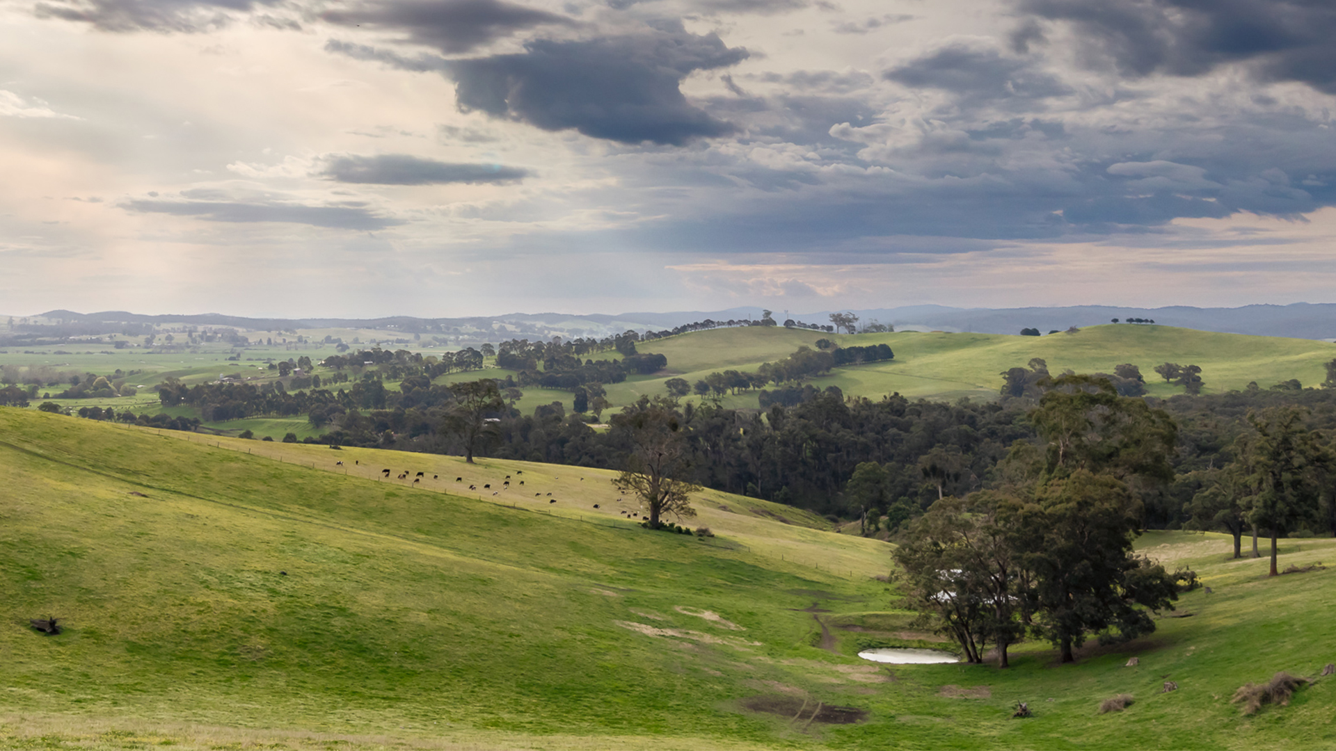
The ‘land theme’ of this Regional Catchment Strategy includes all the terrestrial (land based) environments of East Gippsland. Our land provides for a vast array of natural values and supports important productive enterprises and industry that rely on these values, including agricultural, recreation and tourism.
Our landscape values… a snapshot
The terrestrial environments of East Gippsland support our biodiversity, provide a productive landscape, and offer places to explore and enjoy.
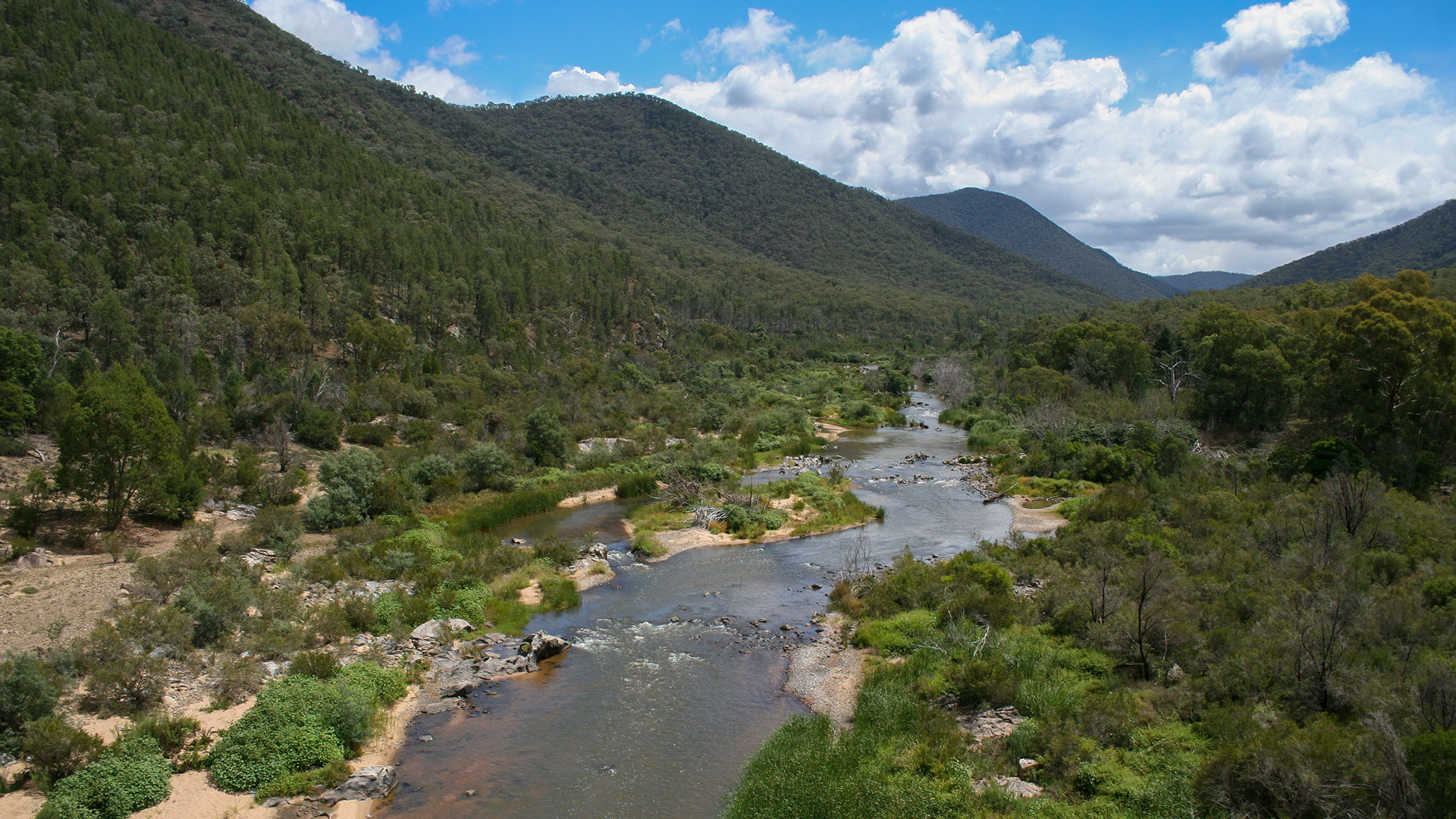
The East Gippsland region covers around 2.2 million hectares and represents around 10% of Victoria. The region is bounded by the Great Dividing Range to the north, where mountain peaks rise to 1870 metres and extends south to the coast.
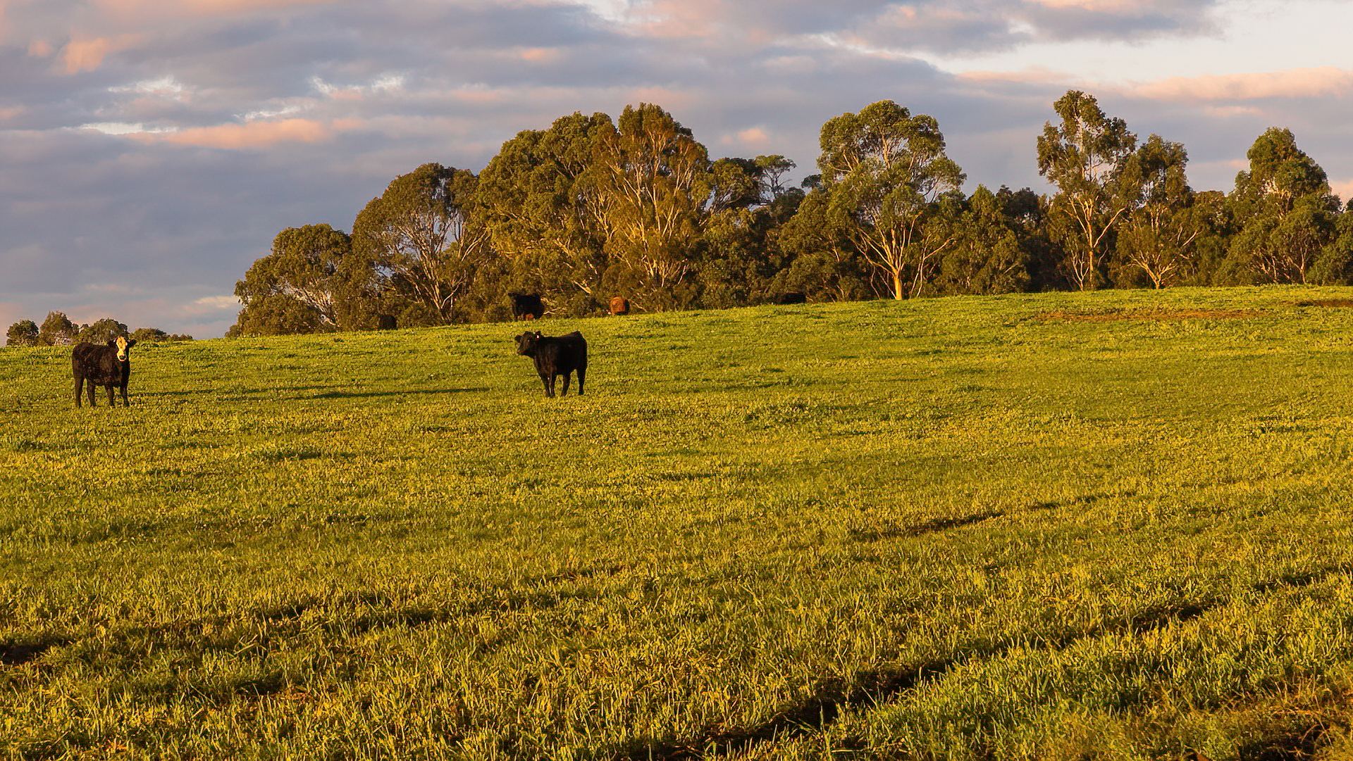
Large areas of public land cover East Gippsland, including state forests, national and coastal parks. Private land covers less than 20% of the region. Grazing occupies the largest area of this private land, with significant productive areas of irrigated horticulture and dairying on the floodplains of the Snowy and Mitchell Rivers.
Soil types across the region vary from east to west and across freehold land, supporting broad scale grazing of sheep and cattle. Intensive horticulture and cropping are limited to the more fertile soils found in the river valleys and on the Redgum Plains.
The climate of East Gippsland is cool temperate and influenced by altitude and distance to the coast.
The landforms of East Gippsland vary considerably from the mountain peaks to the coastal flats with large areas of land in public ownership, mainly as state forests, national and coastal parks.
Areas of broad ridges and plateaus of the alpine area above 1200m in elevation support typically rich loamy or stony shallow soils. At lower elevation flatter areas in the landscape have been cleared by agriculture. Steeper landscapes occur at a range of elevations but are characterised by steep slopes and incised gorges. These areas retain much of their native vegetation.
At the lowest elevations across East Gippsland most of the landforms are terraces and fans, which are characterised by older soils, dunes and terraces. The riverine plains comprise floodplains and morasses and occur in the southwest of the region. Much of this area is freehold land and has been cleared for agriculture.
In the eastern parts of East Gippsland region soils are well structured and fertile with high organic matter content. In the west of the region, soils are generally low in organic matter content, are lightly textured and prone to erosion. The lowlands are characterised by soils of uniform texture contrast.
The climate of East Gippsland is cool temperate and influenced by altitude and distance to the coast. Close to the coast, weather is mild year-round, with rainfall evenly distributed throughout the year. Average rainfall at Cann River is approximately 1,000 mm per year. By contrast, the ranges cause significant rain shadow effects in the Mitchell basin, with average rainfall in the mid valley at Tabberabbera of 660 mm.
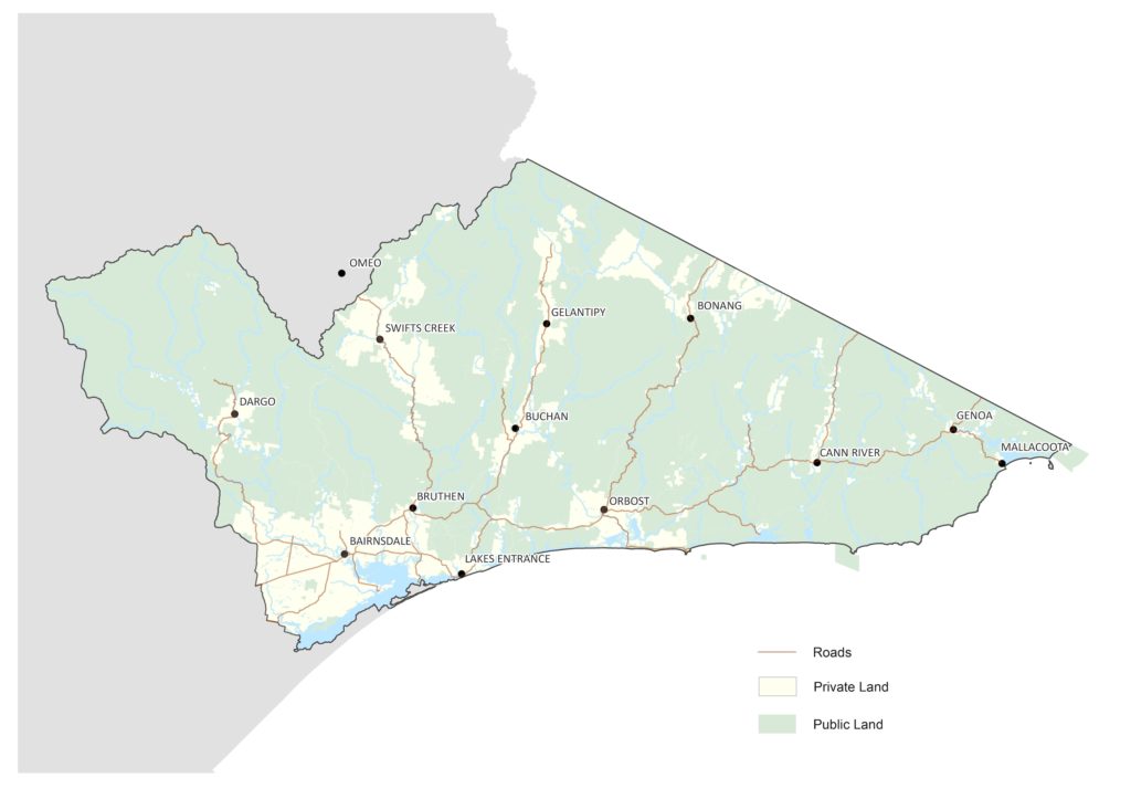
Figure 1: Private and publically owned land in East Gippsland
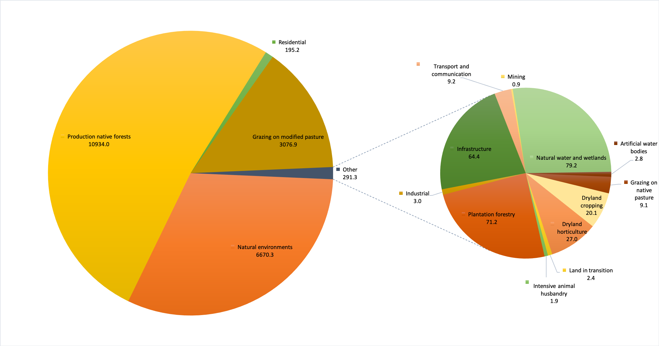
While the vast majority of the land in East Gippsland retains native vegetation, over half of the region is State Forest that can be used for timber harvesting. Grazing and mixed cropping is the next largest land use by area comprising around 14% of the region. By contrast, residential areas represent just 1% of the region and all other land uses individually account for < 1% of East Gippsland (Figure 2).
Table 1: Land use in East Gippsland
Source: Australia’s Environment (ANU-WALD)
Figure 2: Land use in East Gippsland
A hotter and drier climate with reduced water availability will put significant pressure on the agricultural sector. As conditions change, historical farming practices and products may no longer be viable in some areas. Livestock are vulnerable to changes in temperature and water availability and an increase in the number of hot days. Dairy cattle are particularly affected by heatwaves with a reduction in milk productions and an increase in illness and even death. Increased drought and bushfire risk will also affect forestry in East Gippsland with reduced growing rates and prolonged recovery periods.
Over the 2019/20 Black summer bushfires over 1 million hectares (53%) of the East Gippsland region was burnt. Over 900 buildings including homes and sheds were destroyed and over 6,000km of fencing required replacement. Across East Gippsland the economic impact on farms through loss of assets and production has been significant.
For some businesses, the impact of coronavirus (COVID-19) comes in addition to the impact of bushfires and drought, particularly in East and Central Gippsland.
The coronavirus (COVID-19) pandemic has had a significant impact on Victorian agriculture. Our export markets have been challenged by contracting demand and disrupted supply chains. Reduced domestic demand from the hospitality sector has also affected our farmers. Production restrictions – necessary to contain and manage the spread of the virus in Victoria – have also had an impact.
Percent exposed soil
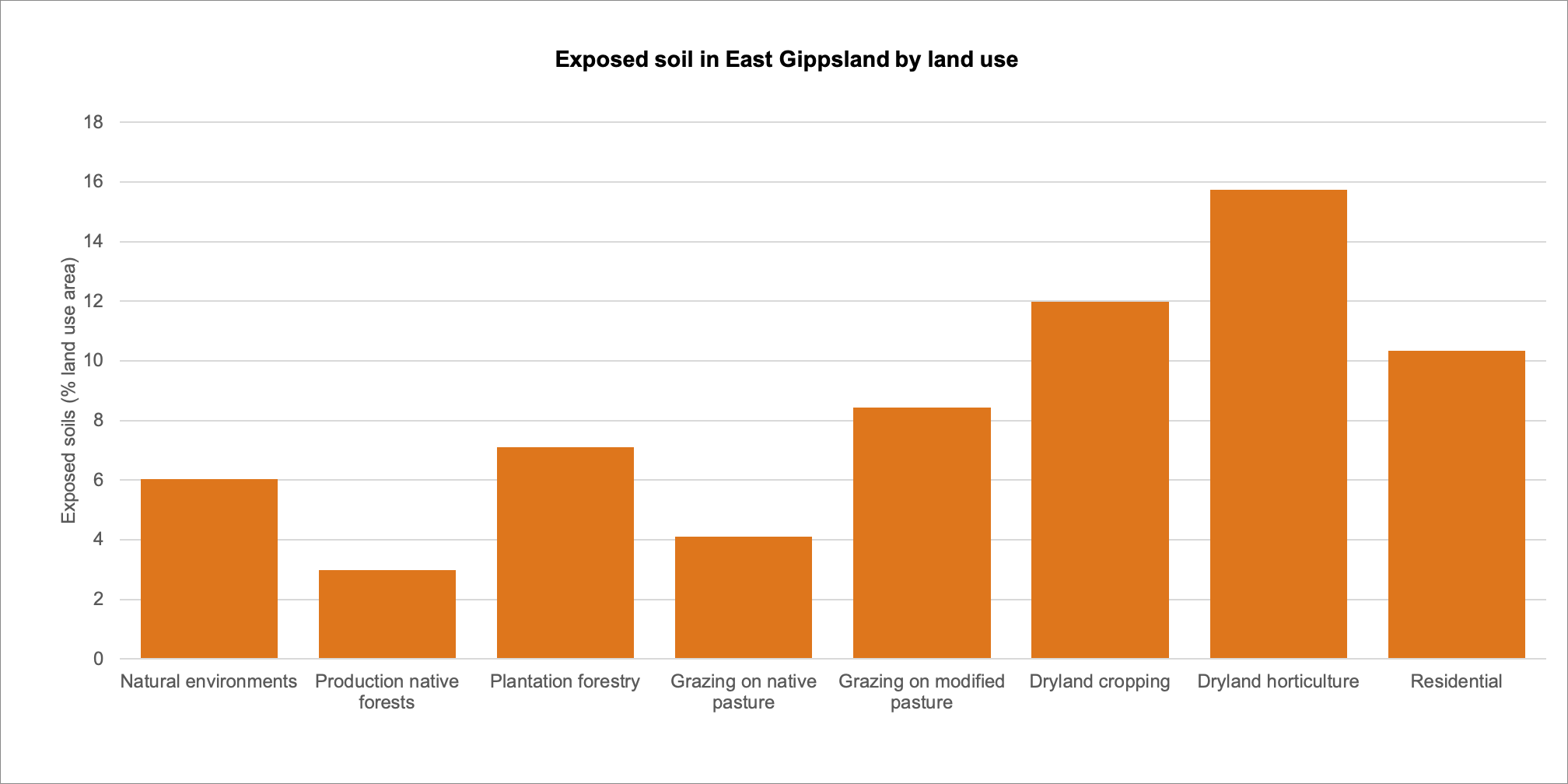
The percentage of exposed soils in East Gippsland is relatively low and generally less than 4% of the total land area (Figure 3). There was an increase in 2020 following the bushfires, but the total exposed soil was still less than 5%. In general, intensive land uses such as cropping, horticulture and residential land have a higher proportion of exposed soil (Figure 4). These land uses, however, cover only a small part of the East Gippsland region.
Figure 3: Percentage exposed soil in the East Gippsland region.
Source: Australia’s Environment (ANU-WALD).
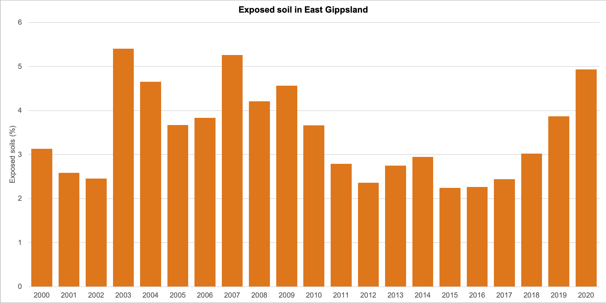
Figure 4: Percentage exposed soil (2020) in the East Gippsland region by land use category.
Source: Australia’s Environment (ANU-WALD).
Extent of land uses
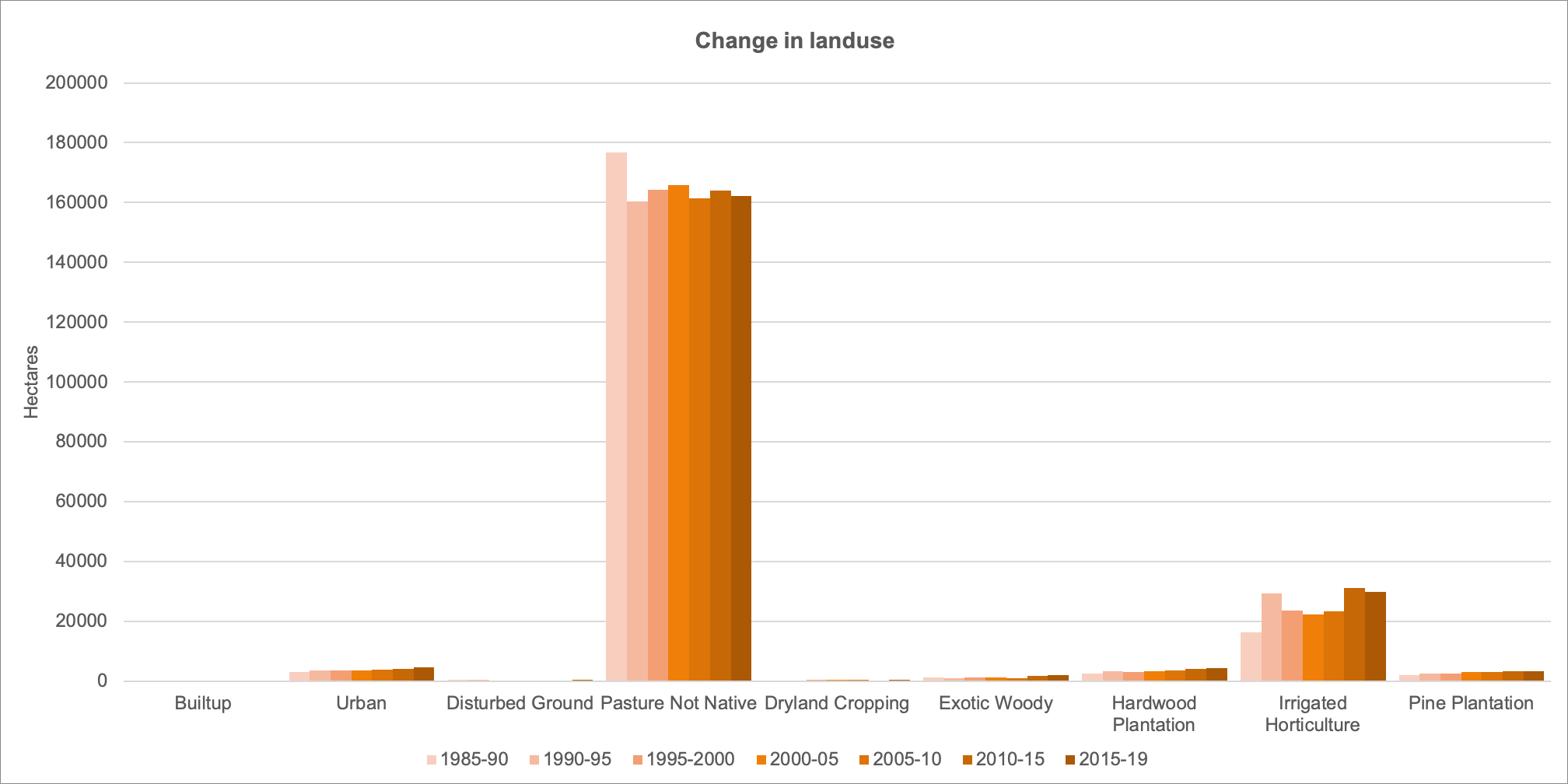
There has been little change in the land uses in East Gippsland as represented by the Victorian Land cover data (Figure 5). There have been very small increases in intensive land uses such as urban areas and irrigated agriculture, but these represent a small fraction of the East Gippsland region.
Figure 5: Change in extent of land uses (hectares) in the East Gippsland Region (please note that the largest land use identified across east Gippsland is ‘Production Native Forest’, however the data set used for this analysis does not include this land use category).
Source: Victorian Land Cover Time Series (DELWP).
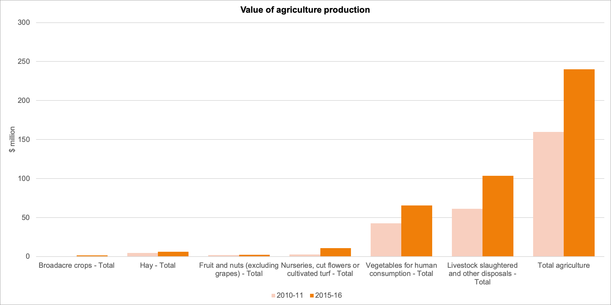
Agricultural productivity
Total agricultural production in East Gippsland increased from around $150 million in 2010-11 to $240 million in 2015-16 (Figure 6). The greatest value was from the vegetable and livestock sectors. This analysis does not account for the value of the timber industry was estimated at $310 million in 2018-19.
Figure 6: Value of agriculture production (excluding the timber industry) in the East Gippsland region.
Source: Australian Bureau of Statistics.
Land – Regional Outcome Targets
These regional outcomes relate to the land theme within the RCS. They set out the long term (to 2040) and medium term (to 2027) outcomes as they relate to the region’s land based assets. The outcomes include those aligned with the statewide outcomes framework (in italics) as well regionally specific outcomes developed in collaboration with RCS partners. The RCS outcomes framework can be found here, and more detailed outcomes addressing each theme of the RCS and linked closely to each of the local areas can be found here.
Medium-term
Outcomes (2027)
Best practice soil management, including maintaining appropriate ground cover is implemented at 60 % of priority sites across the agricultural landscapes.
Landholders will use systems and techniques to deliver long term outcomes for both farming and the environment to improve resilience.
Long-term
Outcomes (2040)
The productive values and stability of agricultural land and soils within the Dargo Mountain Basin, Tambo Valley, Snowy Mountain Basin and Buchan Valley will be maintained.
Over 750 properties across East Gippsland will active sustainable land management practices in place relating to soil and groundcover management.
| Management Direction | Current | Future Opportunity | Partners involved |
|---|---|---|---|
| Continue to develop best practice guides and approaches to support farmers, including through demonstration trials, knowledge sharing days and initiatives. | Agriculture Victoria, Landcare, DAWE, EGCMA, Industry partners and community farmer networks, Private landholders | ||
| Continue to work with landholders to improve soil health and ground cover through education, trials and initiatives, including management of erosion in post bushfire landscapes. | Agriculture Victoria, Landcare, DAWE, EGCMA, Industry partners and community farmer networks, Private landholders | ||
| Ensure appropriate land use through the implementation of the East Gippsland Rural Land Use Strategy (currently draft). | EGSC | ||
| Improve landholder participation in programs to implement best practice, or permanently protect environmental assets, through incentives or stewardship payments. | EGCMA, TfN, DELWP, Landcare, Industry partners and community farmer networks | ||
| Work together to support integrated future fire management planning to provide environmental, social, economic and cultural outcomes. | DELWP, GLaWAC, Parks Victoria, EGCMA | ||
| Support the activities under the Future Drought Fund by working with beef and sheep farmers to build understanding of options to manage drought risks. | Agriculture Victoria, Landcare, DAWE, EGCMA, Industry partners and community farmer networks, Private landholders |